
Accessibility Models
The accessibility models by S&W are among the most recognised models of their kind in Europe due to their theoretical foundation, practical and political relevance and their visualisation techniques. They are used at all spatial levels (including cross-border) from the local to the regional, national to the European scale and in a wide range of detail (e.g. complete integration of public transport timetable data with the public transport module). Uni-, inter- and multimodally, they include numerous modes of transport (car, public transport (overall service, rail, public transport, flexible service forms), bicycle/pedelec, pedestrian transport, electromobility, road and rail freight transport, shipping, aircraft).
Our accessibility models can be linked modularly with geo-information systems. This ranges from loose links via data interfaces to a closely linked direct implementation of accessibility analyses in geo-information systems (QGIS, ArcGIS). Depending on the issue and the purpose of the analysis, different data sources can be integrated on an interface basis, e.g. ATKIS Basis-DLM, OpenStreetMap, proprietary transport network models, HAFAS, GTFS, etc.
Our accessibility models are continuously being further developed. For certain study purposes, the accessibility models can be coupled with our population forecast models, population disaggregation models, settlement development models, site assessment models, scenario planning models of services of general interest, or with our SASI model for forecasting the socio-economic effects of transport infrastructure measures.
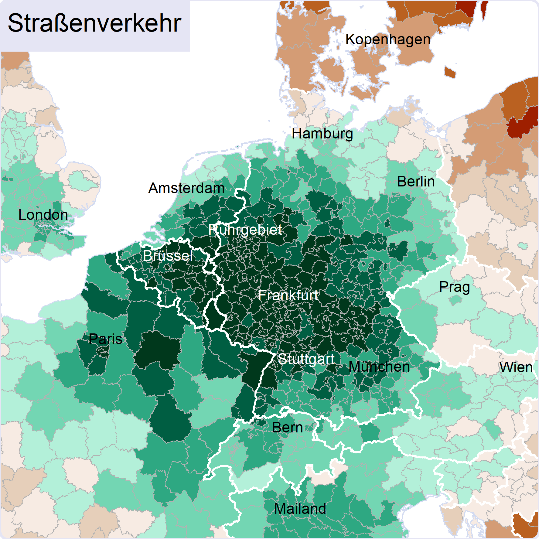
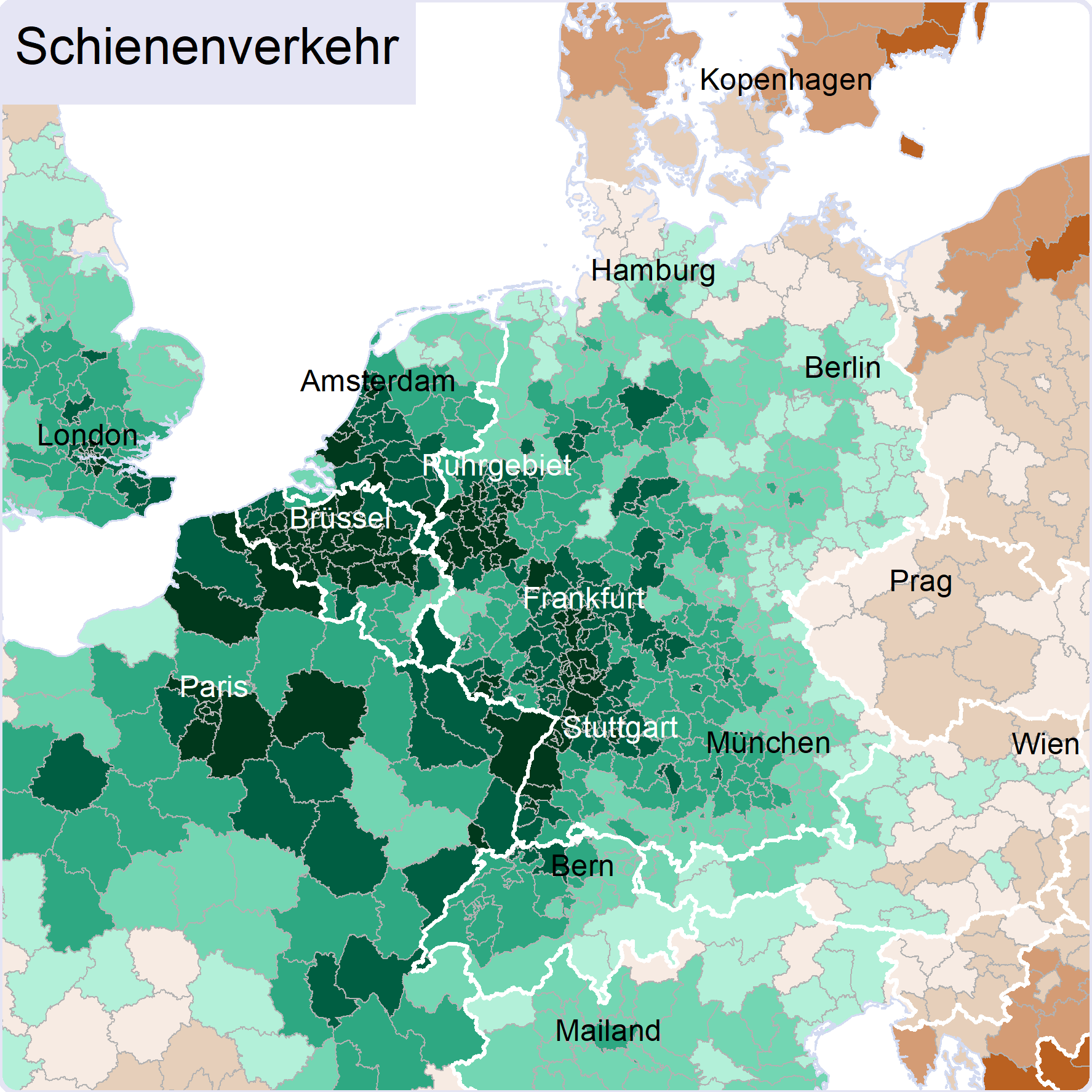
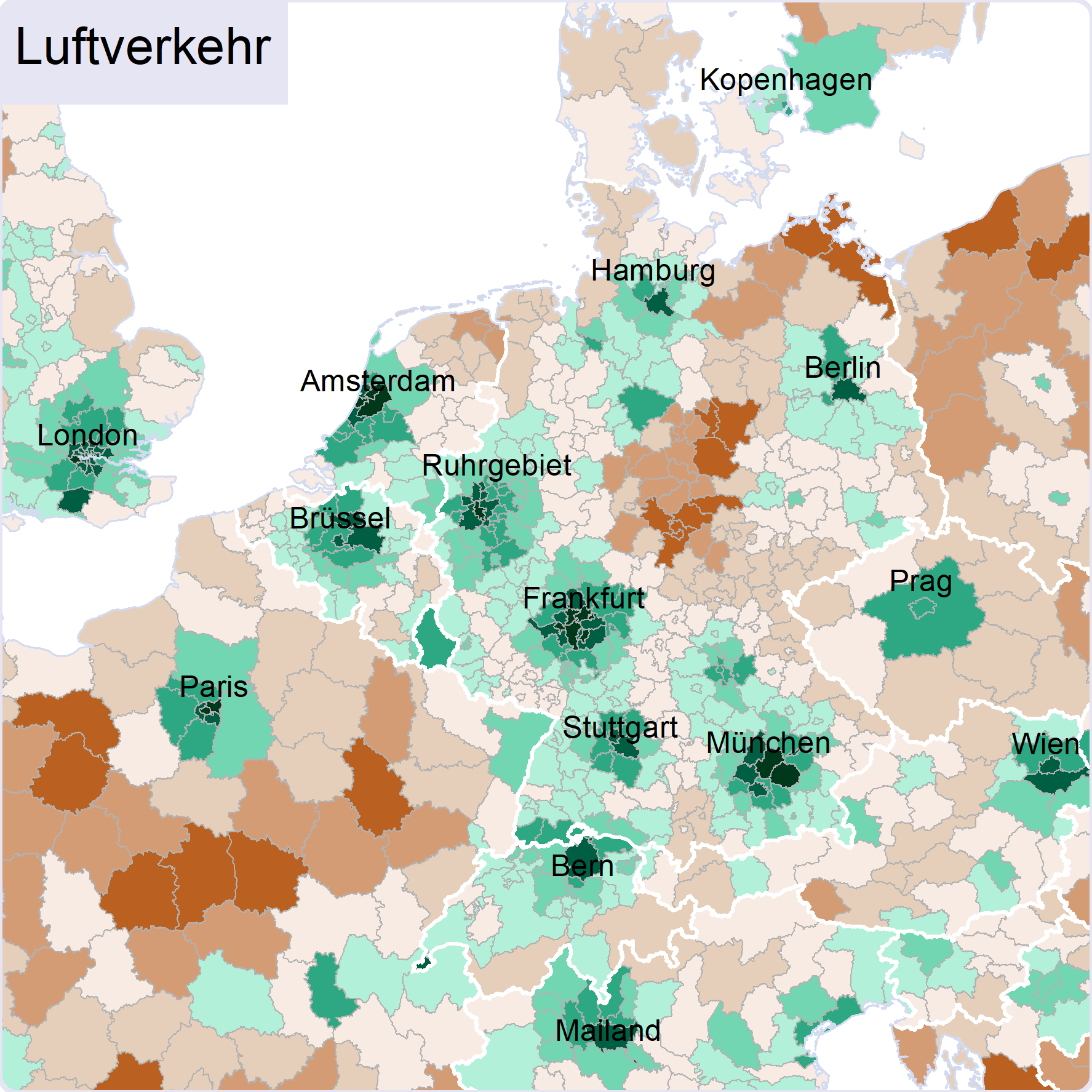
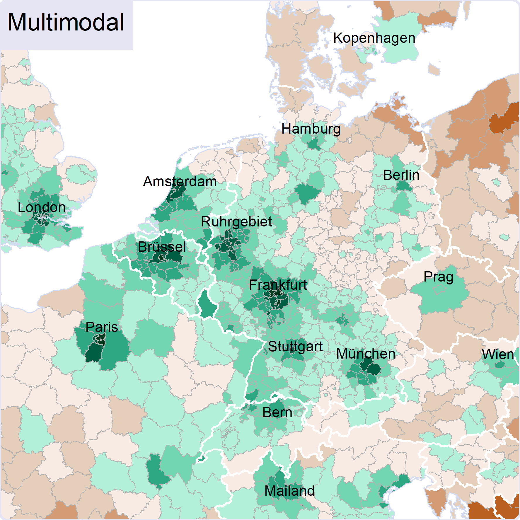
Regional accessibility by road, rail, air and as an overall multi-modal index
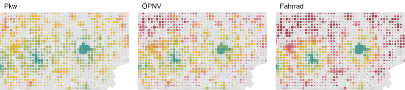
Local accessibility by car, public transport and bicycle (1 km² grid cell size proportional to population size)
