
Public Transport Module
The public transport module enables an uncomplicated integration of digital timetable data into the accessibility analyses with S&W's accessibility models. It is used at all spatial levels from municipal to regional, national and European scales. Basically, the public transport module is implemented so flexibly that any digital input formats can be processed. Tried and tested interfaces have existed for many years for the following formats: GTFS, HAFAS, XML, VDV-45x, DIVA/DINO, Excel, Pdf. In more and more European countries digital timetable data is available in GTFS format for long-distance and local transport, so that the previously often expensive procurement of timetable data is no longer necessary.
Filtering options during the import process of timetable data allow a flexible delimitation of the study area. Within the study area, the existing stops and timetable data are fully taken into account. By defining the study period (e.g. a specific day or time span) and the optional definition of a departure or arrival period, the departure or arrival time corridors to be analysed (e.g. arrival between 9 am and 12 pm) can be specified. Especially when analysing public transport accessibility, the date and time window considered can have a decisive influence on the results, as public transport services can vary greatly in time. After importing, the public transport services can be evaluated graphically and cartographically on a user-specific basis and the imported timetable data can be used for accessibility analyses with our accessibility models as well as for the analysis of catchment areas and passenger potential.
When importing timetable data in our accessibility models, our public transport module automatically identifies possible data errors and gaps (e.g. wrong IDs, wrong or missing coordinates, missing transfer links, unrealistic travel distances and times) via check algorithms and automatically corrects some of them. In addition, the public transport module has a graphical output interface that enables a geographical-visual follow-up check of the imported timetables. A module for neighbour processing of the timetable data enables the correction of data errors or gaps. It is also used to generate accessibility scenarios in public transport services.
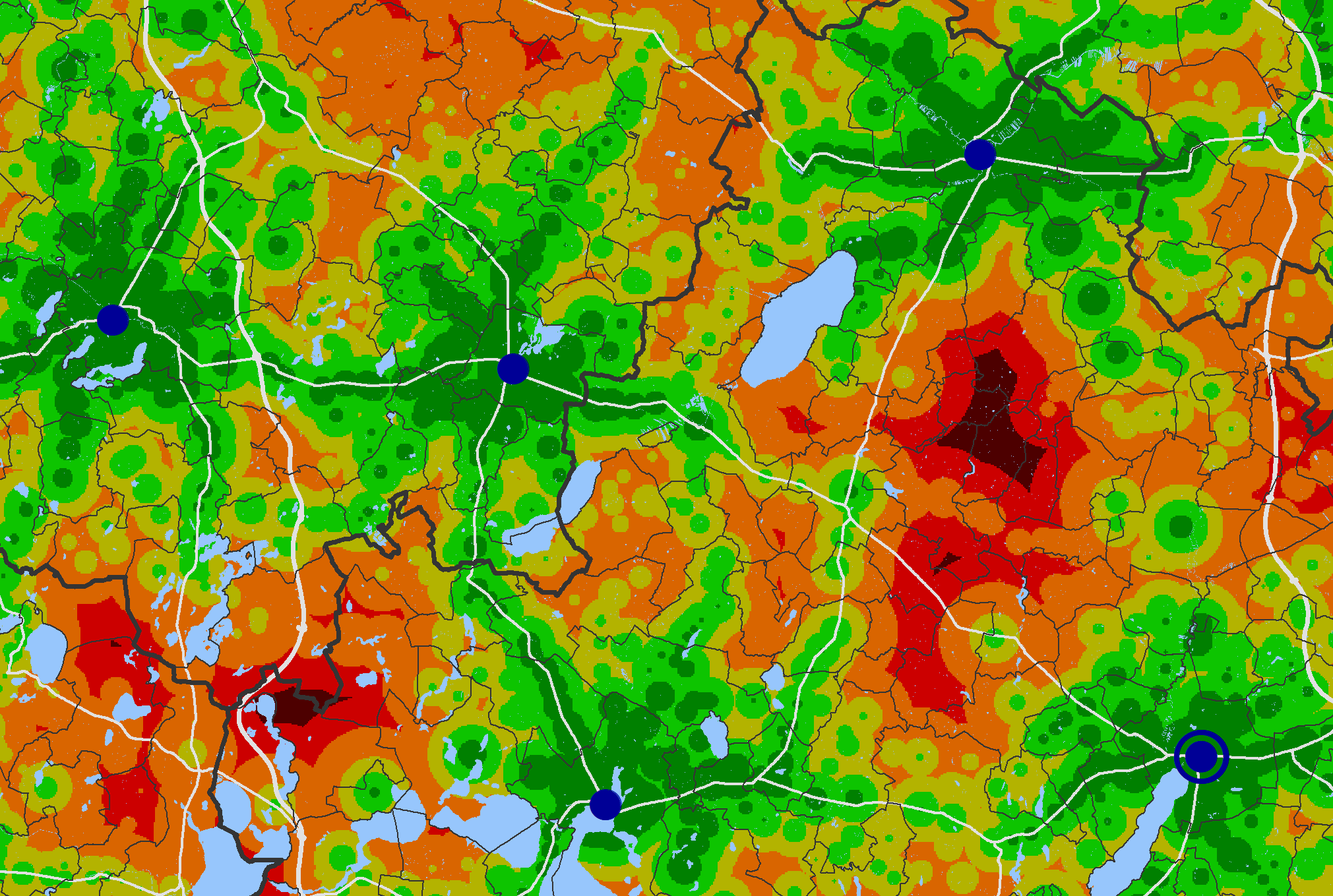
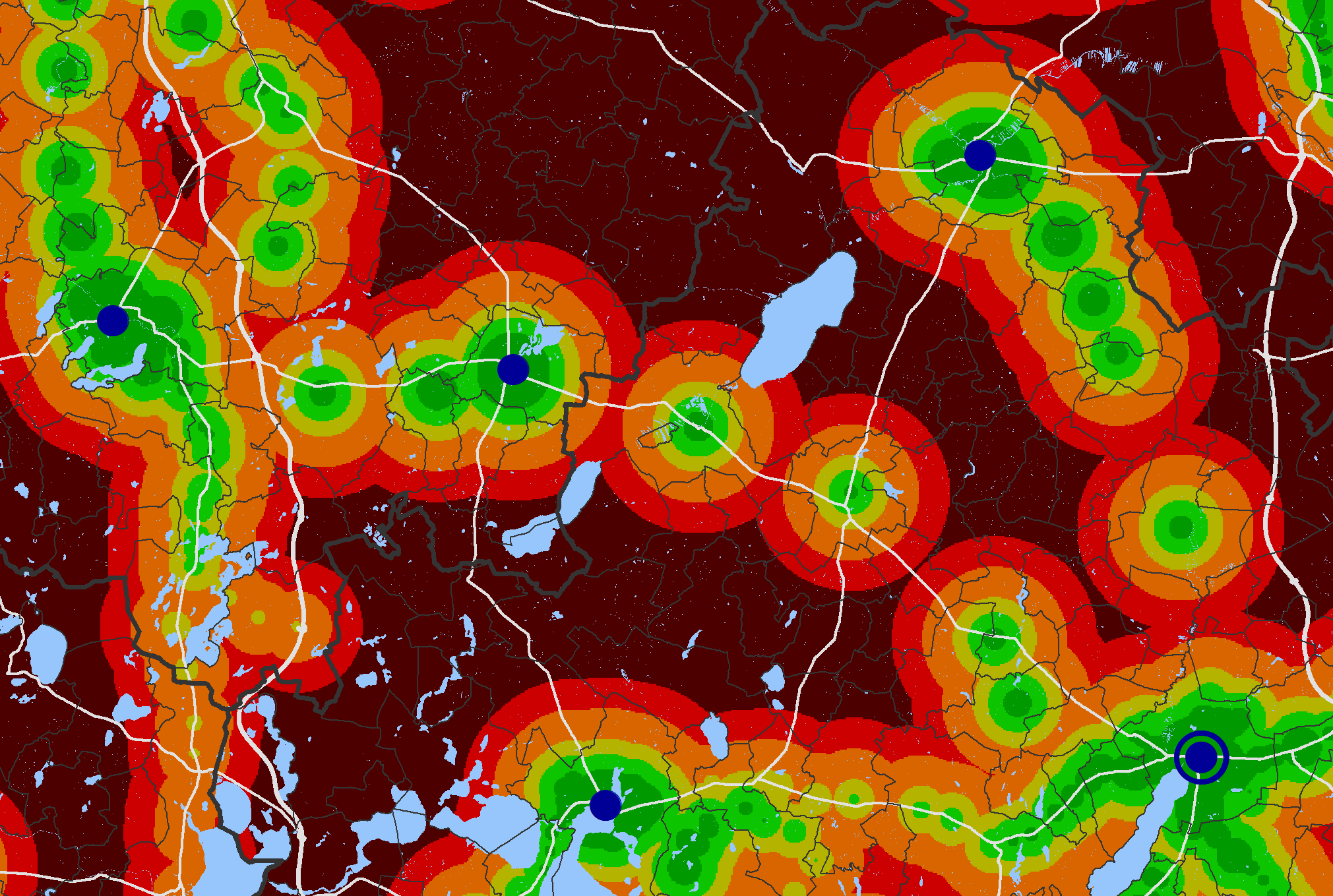
Timetable-accurate accessibility by public transport on a Thursday (left) and on a Saturday (right)
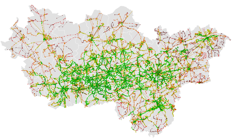
Number of departures at public transport stops on a school day
