Projects

We support our customers with well-founded research studies, planning and expert opinions. Our clients include European institutions, research institutes, federal ministries and associated authorities, state ministries and associated authorities, regions and planning associations, districts, cities, foundations, other public institutions and companies.

The exact form of our work and services is agreed in advance between the customer and us.


References for key word "Visualisation Techniques"


Development of a GIS-based tool for land potential identification and suitability assessment (2019-2021)

Development of a GIS-based tool for land potential identification and suitability assessment (2019-2021)

We have developed the Land Finder to identify suitable potential for residential and commercial land. The Land Finder is a GIS-based tool that can be used to evaluate spatial geodata and geospecialist data in regions and municipalities and to output suitability values with regard to an intended ...

Time-Space Maps

Time-Space Maps

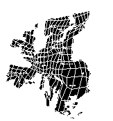
Modern transport technologies reduce the time to overcome space; measured in units of time, space is 'shrinking'. Time-space maps represent this interaction between space and time cartographically. In time-space maps the distance between two points is not proportional to their physical distance (as ...